| Top Page | Mountains, Valleys & Waterfalls |
|
Snapshots |
|
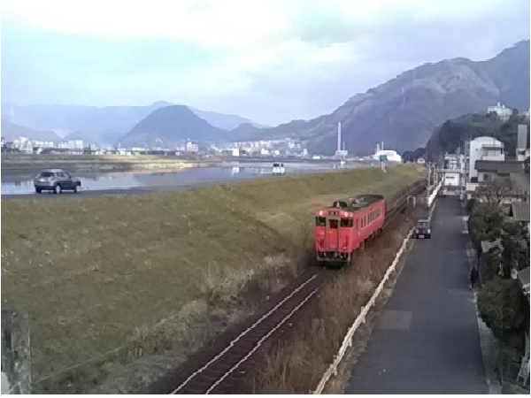
Trains on the Geibi Line
|
The Ohta River
|
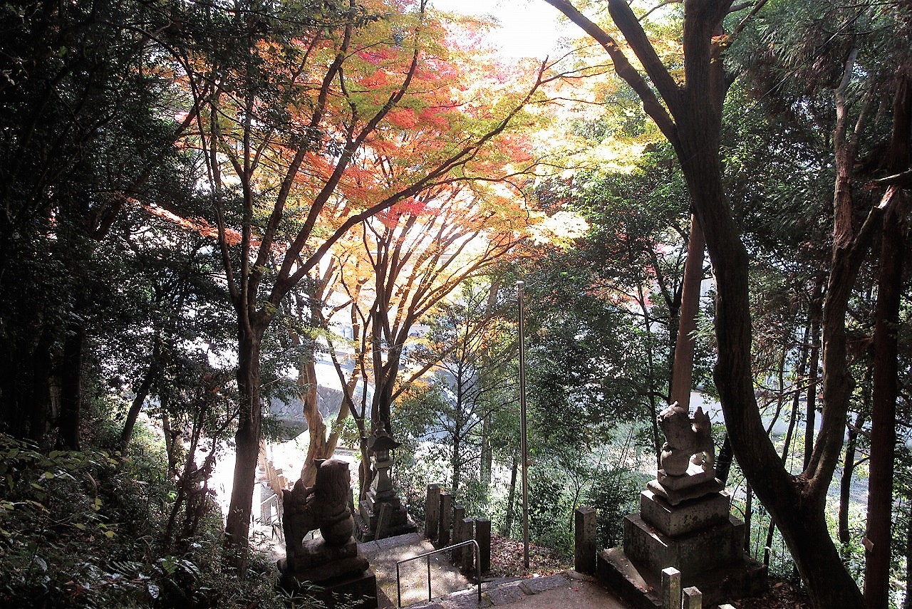
Maple leaves
|
Kamezaki Shrine
|
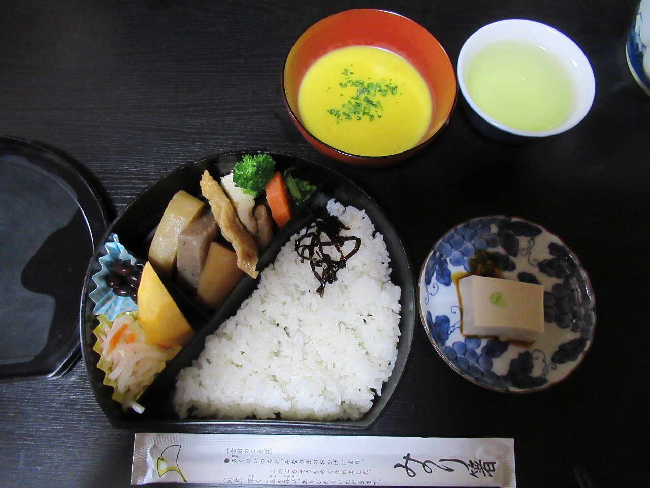
A good meal "Otoki"
|
A memorial service, "Hoonko"
|
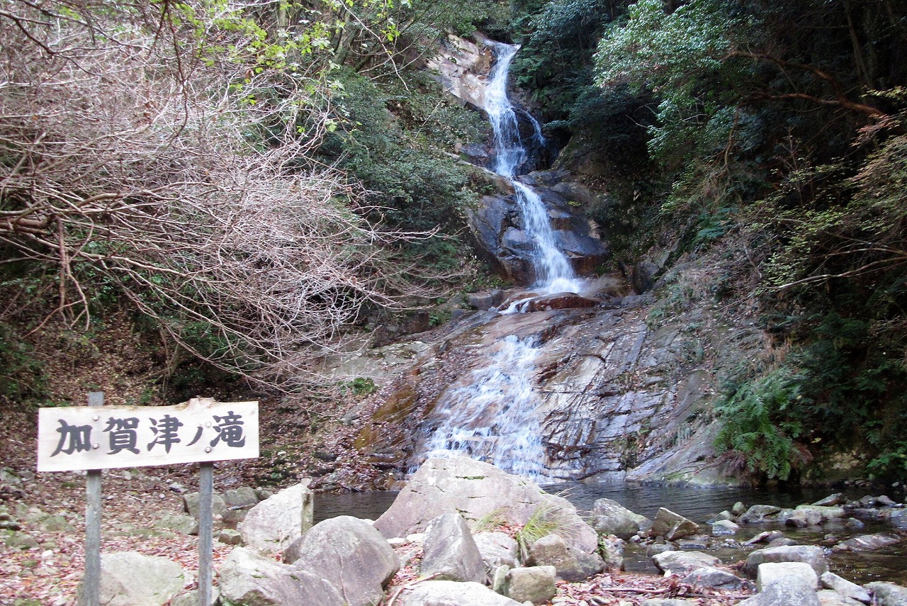
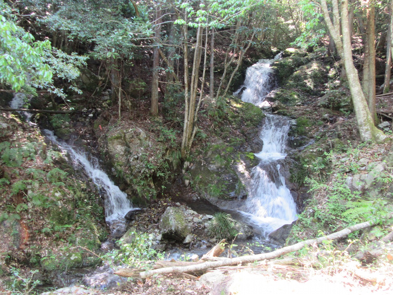
Kagatsunotaki Falls is located in Nabarakyo Valley in
Kabe Town in Hiroshima City.
From Central Hiroshima drive north on Route 54 to Kabe.
After passing through Kabe Tunnel soon turn left at a traffic
signal named Nabara and
enter Route 253. Then drive up to the Nabara Dam for about
3.6 kilometers and go further for about 1.5 kilometers
to Ryuzugahara-enchi parking lot.From there walk up along
a stream for about 15 minutes to the falls |
Nabarakyo Valley is designated as a prefectural nature park.
|
Even in the morning of early November the temperature went down around zero,
when I walked up on the narrow winding road to a small shrine named Bishamonten
which is situated on the hillside. From below the shrine a small village where
I grew up can be seen. |
Sera in mountains |
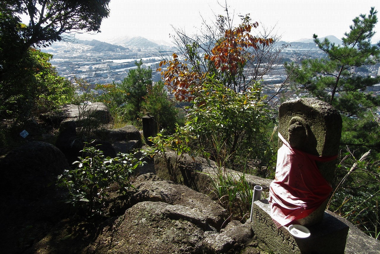
A stone statue of Jizo sits on the hillside of Mt.Iwataki. 88 stone Buddhist images are put on the circular trail of the mountain in numerical order when going up anticlockwise. (Oct.31, 2017) |
The 192-meter-high Mt.Iwataki is located 1km northeast from JR Kaitaichi Station on the Sanyo Line.
From the station walk north crossing three streets to the old Sanyodo, now Route 151.
Then walk east about 600m and turn right at a JA branch office after passing Komyoji Temple.
Walk up and go through the Torii gate to the Iwataki Shrine which is situated in the Iwataki Park.
|
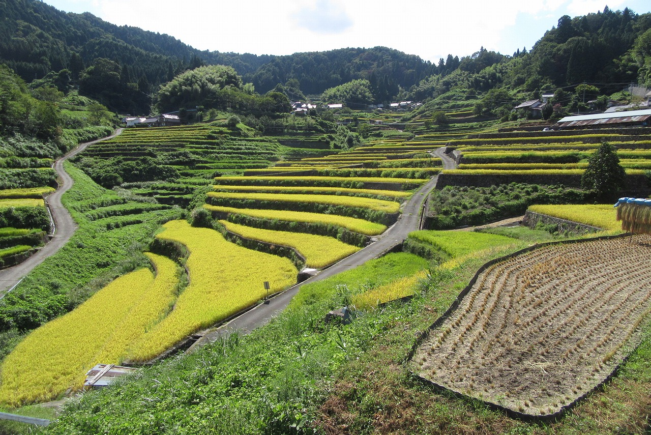
Ini Tanada in Akiohta Town is about to harvest the rice.
American television news channel,CNN says it is one of Japan's 31 most beautiful places.
|
Terraced rice paddies in Ini are called "Ini Tanada".
It is designated as one of the 100 most beautiful tanada by Ministry of Agriculture, Forestry and Fisheries.
|
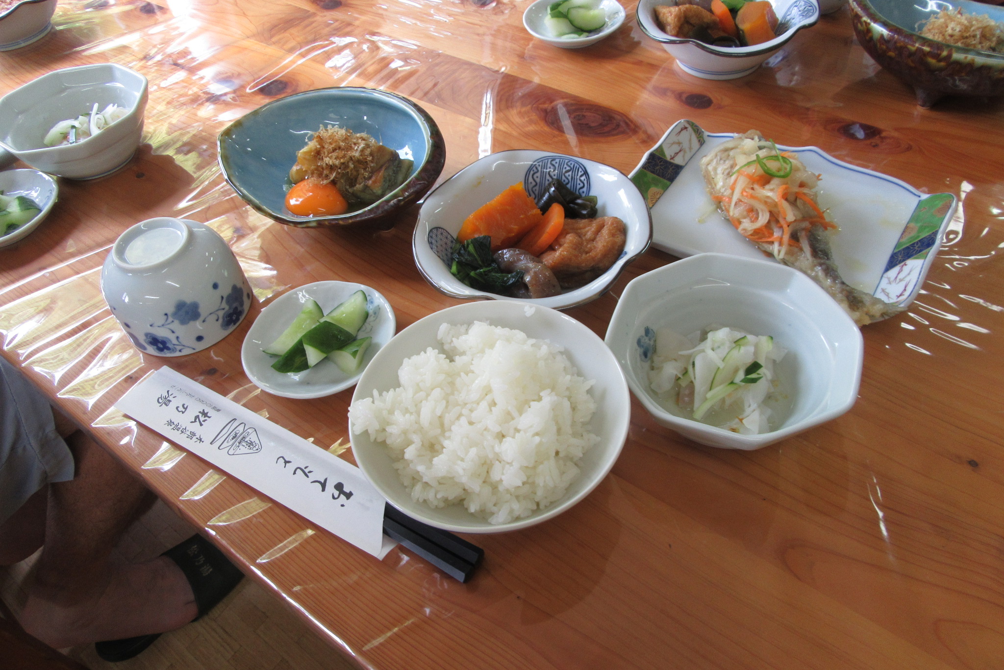
A good 750yen set meal for lunch is served by an elderly landlady at Matsunoyu Onsen
in a rural village,Kakinoki-mura,Shimane Pref. |
Matsunoyu Onsen has a geyser close by. It rises suddenly into the air.
After about a 25-minute pause, it spouts for about 5 minutes.
It is said that the water is 20 degrees and comes out at up to 200 liters per minute, and at first
it is colorless and transparent but gradually turns brown as it touches the air because of iron in the water.
|
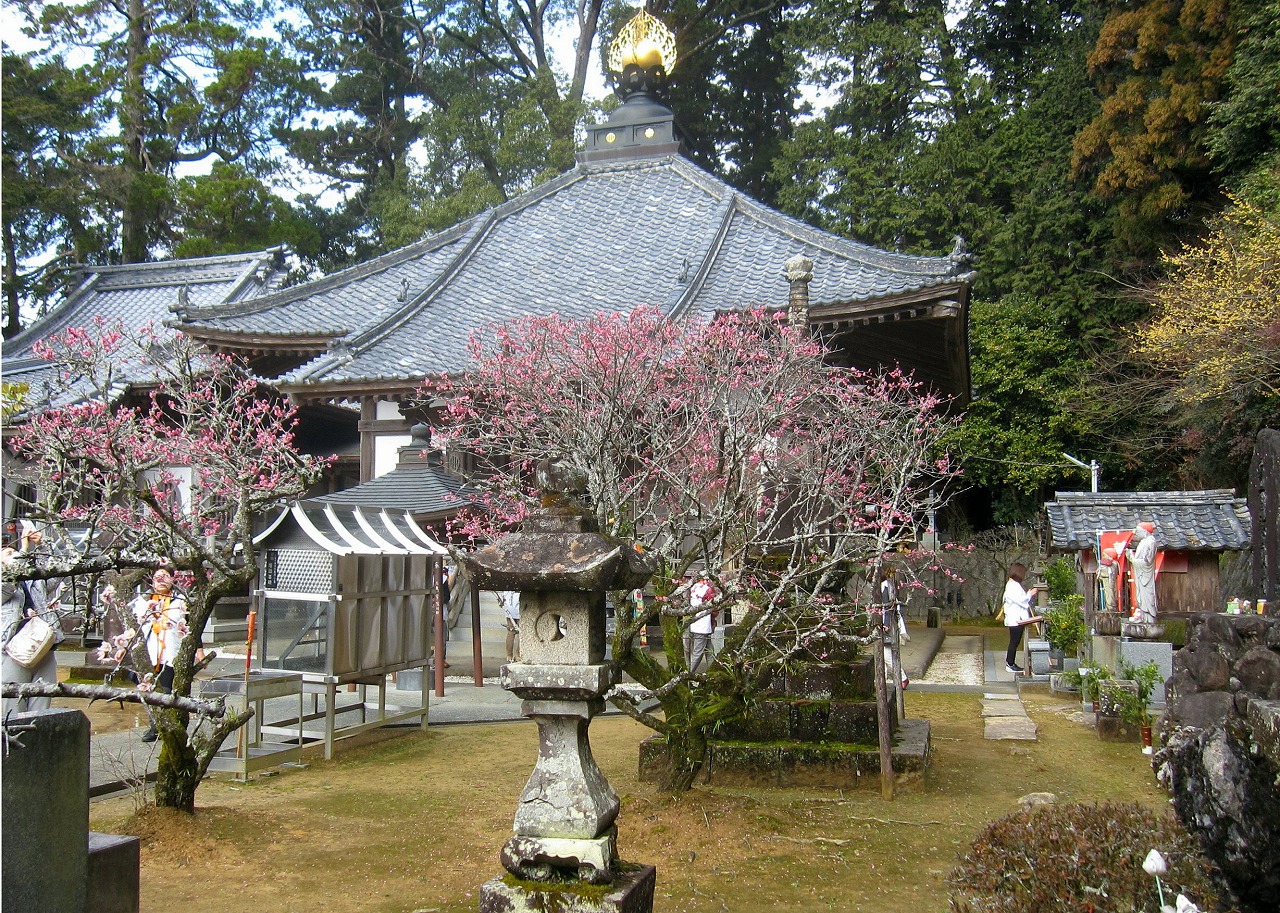
The plum trees are in full bloom on the grounds of the No.42 Butsumokuji Temple in Uwajima City in Ehime Pref. (Feb.18th, 2017) |
We started the 88 temples pilgrimage around Shikoku Island
in October in 2016.
We are visiting temples backwards.
It is said that the pilgrimage that goes around in reverse has triple benefit
compared to the pilgrimage in order, if you begin the pilgrimage in a leap year.
|
The Kudosenotaki Falls are situated in Karuga, Asakita Ward, Hiroshima City. It can be reached
in less than 40 minutes from JR Karuga Sta.
|
Karuga Town was developed along the Misasa River.
|
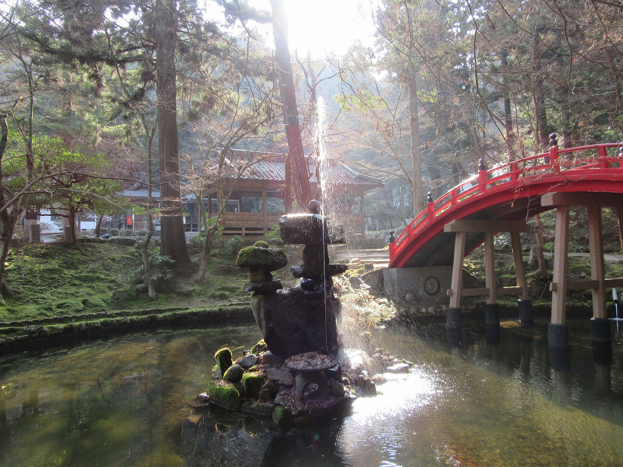
The pond in the grounds of Imakoyasan Temple is glittering with the morning sunshine.
|
Imakoyasan Temple |
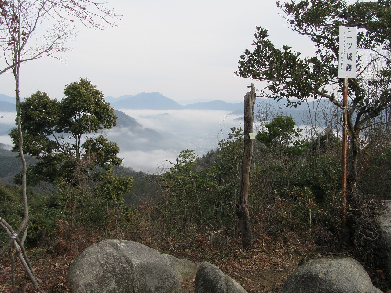
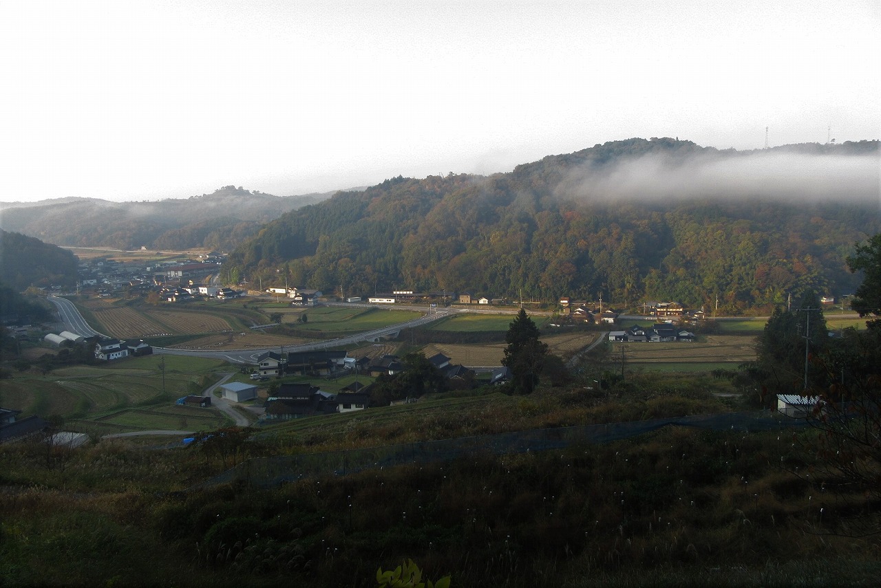
A sea of clouds hovering over the valley can be seen from the top of the 483-meter Mt. Futatsugajo.
|
Mt.Futatsugajo |
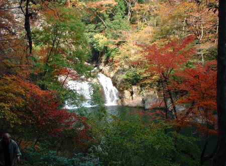
This picture was taken on Thursday, Nov.3,2005. |
The autumn leaves at Mitsudaki Falls |
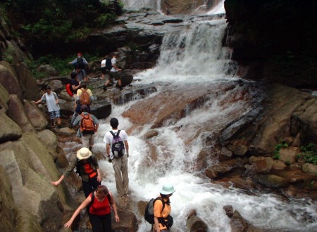
This pictures was taken on Saturday, July 20, 2002. |
Miyamakyo Valley
|