| Top Page | Mountains, Valleys & Waterfalls |
|
Mt. Takao (424m) |
|
|
|
|
Fuchu Town Aki-gun | |
|
高尾山 | |
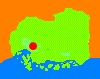
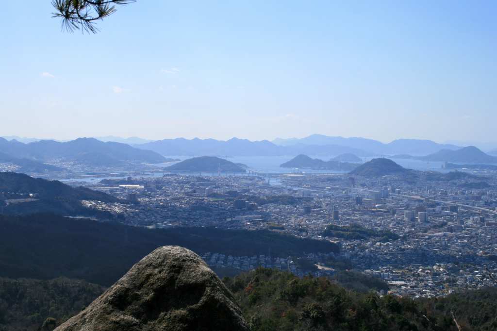
| Map | A beautiful view of central Hiroshima and Hiroshima Bay in the background can be seen from the top of Mt. Takao. |
|
The 424-meter rugged Takao mountain is 5 kilometers northeast from downtown Hiroshima,
and stands on the border of Hiroshima City and Fuchu Town.
Mikumarikyo Valley, which is situated at the foot of the mountain and the 682-meter neighboring Mt. Gosaso,
is in the north of Fuchu Town. Fuchu is surrounded by Hiroshima City, and uniquely,it is a detached town of Aki County. In ancient times government offices were called "kokuga" or "fuchu". In the 7th century a Japanese constitutional form of government was introduced, modeled after that of China so that the land and people were put under the direct control of the state. This town is said to be a place where a government office of Aki Province was located. It prospered as a center of transportation and an Aki Province rest station for travelers because the Sanyodo highway passed through the town. Mikumarikyo Valley has been attracting many hikers all year round, but in recent times the natural functions of the forest had been reduced greatly because of being ravaged by pine bark beetles. So this area was developed as one of the Living Environment and Woodland Conservation projects by Hiroshima Prefecture in order to restore the forest to health and recreate a secure and pleasant landscape. Now Mikumarikyo has been reborn and has become a beautiful forest park. From JR Yaga Station of the Geibi Line walk northeast for about two kilometers to an old temple named Doryuji in Mikumari 3-chome in Fuchu Town. Click this link to see an access map of Doryuji Temple (Nihongo). Doryuji Temple was said to be built in the Heian period (794-1192), and its Buddhist image of Yakushi-nyorai, a guardian of health, has writing on it in sumi or Indian ink that says it was made in 1201. From the temple make a 1.5-hour ascent to the summit of Mt. Takao. The panoramic view of the entire Hiroshima City from the top of the mountain is really breathtaking. To go down to Mikumarikyo Valley Forest Park walk down the same trail for about 1.5 kilometers, then turn left to the forest park. Click this link to see a map of Mikumari Valley Forest Park (Nihongo). To return to central Hiroshima walk south for about two kilometers down the paved road along the Enoki River to Fuchu-Enomiya busstop to catch a Hiroden bus for Kencho (Prefectural Office)-mae. Fuchu-Enomiya busstop is located in front of Enomiya Shrine. Getting there: Take a train on the JR Geibi Line from Hiroshima Station and get off at Yaga Station. Suggested schedule: Hiroshima Sta.(9:00)==(Geibi Line)==Yaga Sta.(9:04)--- ---Doryuji Temple(9:40)---Mt. Takao(11:30-12:30)--- ---Mikumarikyo---(13:30-14:30)---Fuchu-Enomiya busstop(15:25)== ==(Hiroden Bus)==Hiroshima-eki(Hiroshima Sta.)-mae(15:45) *Train and bus timetables may be subject to change. Note: To be safe, especially in winter, keep in mind not to go into the mountains alone, and be sure to go with a well-experienced hiker. |
|