| Top Page | Mountains, Valleys & Waterfalls |
|
Taishakukyo Valley |
|
|
|
|
Tojo Town, Shobara City | |
|
帝釈峡 | |
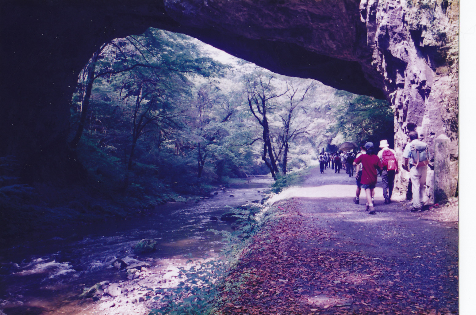
| Map | Hikers walk under the Onbashi Natural Bridge in Taishakukyo Valley. |
|
Taishakukyo Valley, a part of the Hiba-Dogo-Taishaku Quasi National Park, is situated in the northeastern part
of Hiroshima Prefecture. It is said that underground water began to erode a karst plateau, a mass of limestone
which was susceptible to eroding by water hundreds of millions of years ago.
As a result, a number of limestone caves were created there, and they turned into a spectacular 18-kilometer-long
gorge with soaring walls, rapids, falls and natural bridges after their ceiling fell out. In the upper reaches of the Taishaku River, there is an old temple called Eimyoji which is said to have been founded in the 8th century and dedicated to the Buddha called Taishakuten. It is the origin of the name of Taishakukyo. Some 90 years ago, the lower reaches of the river were dammed for hydroelectric generation and a 24-kilometer in circumference lake, Shinryuko (Lake of the Divine Dragon), was made. It provided additional beauty to the valley. A good walking course extends from the temple to the Somendaki Falls, passing by the 200-meter-long Hakuundo Cave which is one of 30 limestone caves, the Onbashi Natural Bridge, Dangyokei Rapids and a trout fish farm. Onbashi (male bridge), a limestone bridge, measures 90 meters in length, 40 meters in height and 18 meters from the riverbed. A part of the ceiling of the limestone cave has remained intact. It is designated as a natural monument of the nation and one of the world's three biggest natural bridges. It's counterpart, Menbashi (female bridge) is now submerged in the water of the lake. Walk down the valley to the Somendaki Falls. The round trip will be about 6 kilometers. Getting there: Go by car. Take the Chugoku Expressway and get off at Shobara. Take Route 432 to Mineta, then take Route 23 to Kami-taishaku. Follow the signboard that reads " 帝釈峡 " which means Taishakukyo Valley. Suggested schedule: Hiroshima(8:00)===(Chugoku Expressway)===Shobara exit===(Rte.432)=== ===Mineta===(Rte.23)===Kami-taishaku Sainokawara(10:30)--- ---Eimyoji temple---Hakuundo Cave---Onbashi Bridge--- ---Dangyokei Rapids---Trout Fish Farm---Somendaki Falls--- ---Trout Fish Farm---Dangyokei Rapids---Onbashi Bridge--- ---Kamitaishaku Sainokawara(14:00)===(Rte.23)===Mineta==(Rte.432)=== ===Shobara===(Chugoku Expressway)===Hiroshima(17:00) Note: To be safe, especially in winter, keep in mind not to go into the mountains alone, and be sure to go with a well-experienced hiker. |
|