| Top Page | Mountains, Valleys & Waterfalls |
|
Mt. Suzugamine (312m) |
|
|
|
|
Inokuchi, Nishi Ward Hiroshima City | |
|
鈴が峰 | |
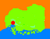
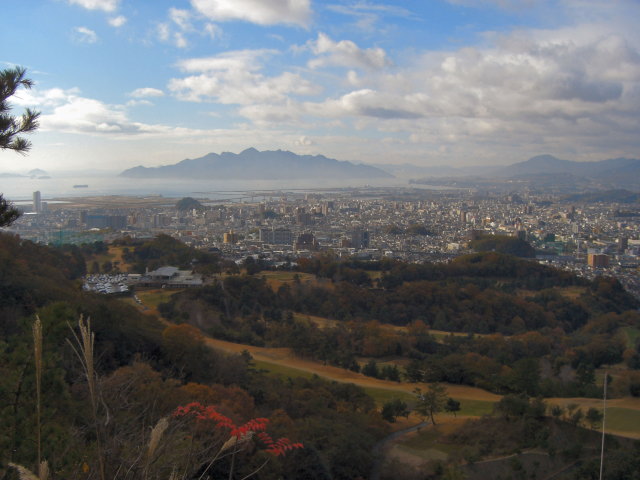
| Map | From the East Peak of Mt. Suzugamine you can enjoy a breathtaking view of the Inland Sea including Miyajima, Ninoshima, Nomi islands and so on. |
|
Mt. Suzugamine, situated in Nishi Ward about seven kilometers west of Central Hiroshima,
is a popular hiking spot at a convenient distance from railway stations. Take a bus for Yamada-danchi for 10 minutes to Yawata-Higashi Primary School from the north exit of JR Itsukaichi Station. Then cross the road and enter the narrow road at a foreign car shop. It leads you to a mountain trail to the 320-meter high West Peak of Mt. Suzugamine. It takes about one hour. You can continue to walk for 20 minutes along the mountain ridges to the 312- meter East Peak of the mountain. You can see JR Shin-Inokuchi Station and Alpark shopping center just below the East Peak. Go down to Shin-Inokuchi Station, passing Suzugamine Ikoi no Mori (鈴が峰憩の森), which literally means Mt. Suzugamine Relaxation Forest. Getting there: Take a train on the Sanyo Line, and get off at Itsukaichi Station. Click this link to see a map of Mt. Suzugamine (Nihongo). Suggested schedule: Hiroshima Sta.(8:20)==(Sanyo Line)==Itsukaichi Sta.(8:36-8:50)== ==(bus)==Yawata-Higashi Primary School bus stop(9:00)--- ---Suzugamine West Peak (10:00)---Suzugamine East Peak(10:30-11:00)--- ---Shin-Inokuchi Sta.(12:18)==(Sanyo Line)==Hiroshima Sta.(12:32) *Train and bus timetables may be subject to change. Note: To be safe, especially in winter, keep in mind not to go into the mountains alone, and be sure to go with a well-experienced hiker. |
|