| Top Page | Mountains, Valleys & Waterfalls |
|
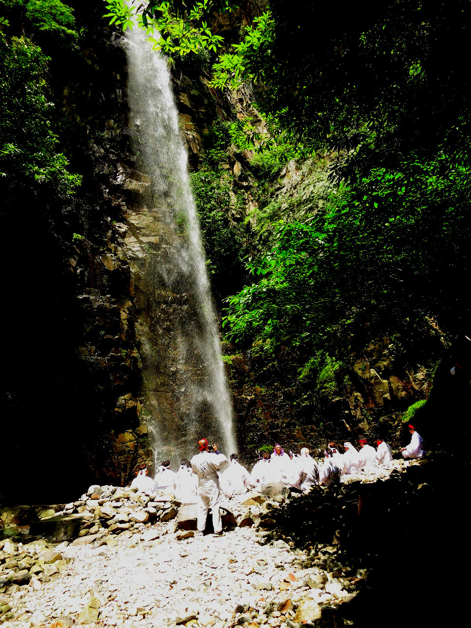
Shiraito-no-taki Falls |
|
|
|
|
Hiro Tokumaru Kure City | |
|
白糸の滝 | |
| Map |
Shiraito-no-taki Falls Local residents sometimes hold ascetic practices in the basin of the falls, standing under the falls. |
|
Shiraito-no-taki Falls is situated in the middle reaches of the Shiraito River. The Shiraito River flows into
the Kurose River at a point 6 kilometers north from its mouth. It is great to see water falling straight down over
a 38-meter high cliff.
From the Tokumaru bus stop walk for several minutes along Route 375, which runs parallel to the Kurose River, untill passing through a tunnel and go down to the riverside. Then walk to the Koitobashi Bridge which spans the Kurose River. You can see the overpass of the Higashi-Hiroshima-Kure Expressway which provides a convenient landmark. Then cross the suspension bridge and make a 30-minute ascent on the narrow and steep paved path to the falls which is 130 meters above sea level. Nikyu Falls, which is located 2 kilometerw north from Shiraito-no-taki Falls, is another good hiking spot. There are a number of falls between them. Getting there: Take a train for Hiro on the JR Kure Line and get off at Shin-Hiro Station. From in front of the station, take a 10-minute bus ride bound for Kurose to Tokumaru. Suggested schedule: Hiroshima Sta.(8:51)==(Kure Line)==Shin-Hiro Sta.(9:45-9:56)== ==(bus)==Tokumaru(10:05)---Koitobashi Bridge--- ----Shiraito-no-taki Falls(11:00-12:00)--- Koitobashi Bridge--- ---Tokumaru bus stop(13:43)==Shin-Hiro Sta.(13:55-14:06)== ==(Kure Line)==Hiroshima Sta.(14:53) Note: To be safe, especially in winter, keep in mind not to go into the mountains alone, and be sure to go with a well-experienced hiker. |
|