| Top Page | Mountains, Valleys & Waterfalls |
|
Mt. Osorakan (1,346m) |
|
|
|
|
Togouchi, Akiota Town, Yamagata-gun | |
|
恐羅漢山 戸河内 | |
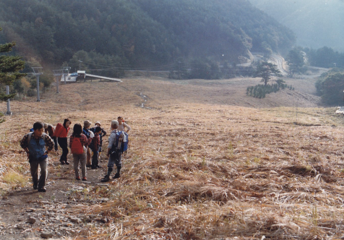
| Map | Hikers walk up on the slope of Mt. Osorakan. |
|
Mt. Osorakan is the highest mountain in Hiroshima Prefecture, and lies to the west of
Sandankyo Valley. A 1000-meter-long downhill slope is particularly popular among skiers.
Around the foot of the mountain is Ushigoya Highland where there are a camping site, a rest house,
minshuku tourist homes and pensions. After parking at the parking place of Ushigoya Kogen camping ground, go back a bit to the rest house. You can find a trailhead (Tateyama course) at the back of the rest house. Take an hour ascent to the top of the mountain including walking up on the ski slope for 20 minutes. Around this area is one of the habitats of Tsuki-no-waguma bears, so putting a bell on your backpack in order to let them know of your presence is recommended, as well as blowing a whistle to send them away. Getting there: Go by car. Travel on the Chugoku Expressway, and get off at the Togouchi exit. Then take Route 191 to Myojinbashi Bridge (明神橋) in Togouchi and turn left. Follow the signboard that reads " 恐羅漢スキー場 ” which means Osorakan skiing ground. Suggested schedule: Hiroshima(8:30)===(Rte.54)===Kabe===(Rte.191)===Hiroshima-kita I.C.=== ===(Chugoku Expressway)===Togouchi Exit(9:30)===Myojinbashi Bridge=== ===Ushigoya Kogen camping ground parking place(10:15)---Rest house--- ---Mt. Osorakan(11:30-12:30)---Natsuyake no kibire(13:30)--- ---Ushigoya Kogen camping ground parking place(14:00-14:20)==== ===Myojinbashi Bridge===Togouchi(15:00)===(Rte.191)===Kabe===Hiroshima(17:00) Note: To be safe, especially in winter, keep in mind not to go into the mountains alone, and be sure to go with a well-experienced hiker. |
|