| Top Page | Mountains, Valleys & Waterfalls |
|
Mt. Matsukasa (374m) |
|

|
|
|
Hesaka, Higashi Ward
Hiroshima City | |
|
松笠山 | |
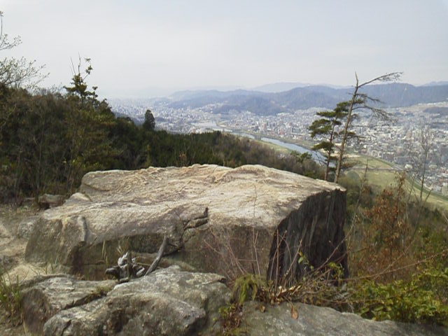
| Map | A view of Central Hiroshima from Hachijoiwa Lookout at the northern side of Mt. Matsukasa. |
|
The 374-meter-high Mt. Matsukasa, situated in Higashi Ward about nine kilometers northeast of Central Hiroshima,
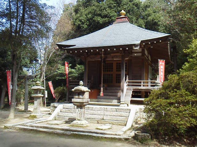
is a popular hiking spot at a convenient distance from the bus stops and the railway stations. There is a temple named Matsukasa Kannonji on the hillside of the mountain. The principal image of the temple is Kannon, the Goddess of Mercy, whom local people have had faith in for a long time. The temple is surrounded by a grove of huge trees such as Japanese cedars and cypresses. They are designated as precious natural monuments by Hiroshima City. On the grounds of the temple are the main hall along with the bell tower, the stone lanterns and so on. There is also cold spring water that moistens visitors' thirst. You will be able to fill your water bottle full. Click this link to see Matsukasa-kannonji Temple. From the grounds of the temple, take a five-minute walk up to Hachijoiwa (八畳岩)Lookout. Then take a 30-minute ascent to the top of the mountain. The view from the mountaintop is great. If the weather is good, you can see the shining Inland Sea beyond western Hiroshima City under the blue sky. After going down to the temple, take a 35-minute descent to Hesaka Station (戸坂駅). Getting there: * From Hiroshima Station, take a 15-minute train ride on the Geibi Line, and get off at Yaguchi Station. Then take a 1.5-kilometer walk toward Hiroshima on the road to Oda-Kyoenji bus stop, and then enter the trail to Matsukasa Kannonji (松笠観音寺). * Or take a 25-minute bus ride for Koyo Shako from the No.11 gate of Hiroshima Bus Center, and get off at Oda-Kyoenji bus stop. Buses bound for A Danchi, B Danchi, C Danchi or Naka-Fukawa will stop at Oda-Kyoenji. (However, express buses don't stop at the bus stop). Suggested schedule: Hiroshima Sta. ==(Geibi Line)==Aki-Yaguchi Sta.(10:15)--- ---Oda Kyoenji Temple(10:40)---Matsukasa Kannonji Temple(11:40-12:30)--- ---Hachijoiwa Lookout(12:35)---Mt. Matsukasa(13:05-13:20)--- ---Matsukasa Kannonji Temple(14:00)---Hesaka Sta.(14:35) *Train and bus timetables may be subject to change. Note: To be safe, especially in winter, keep in mind not to go into the mountains alone, and be sure to go with a well-experienced hiker. |
|