| Top Page | Mountains, Valleys & Waterfalls |
|
Mt. Madogayama (711m) |
|
|
|
|
Numata, Asaminami Ward, Hiroshima City | |
|
窓が山 沼田町 | |
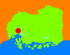
| Map | A window-like gap,the lowest part between the two peaks,is the origin of the mountain's name. Mado means window in Japanese. |
|
The 711-meter Mt. Madogayama sits on the westernmost part of Hiroshima City,
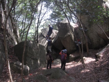
about six kilometers from Hiroshima Big Arch (a soccer stadium). The mountain’s two peaks, the West Peak and the East Peak, both stand out and there is a deep gap between the peaks. That makes it easy to be recognized from a distance. The north side of the mountain is a relaxation forest. From there take a 40-minute ascent to the East Peak, from where you can see a breathtaking view of the Seto Inland Sea. Then take a 30-minute round trip to the West Peak. First go down on a steep trail to the lowest part of the gap and climb up to the West Peak which is the highest point of the mountain. Getting there: Go by car. From downtown Hiroshima, take Route 54 toward Ushita and enter Gion-shindo,which is also Route 54, at Fudoin Temple. After passing Nakasuji Bus Terminal,veer left onto Route 38 and drive along the Astram Line about eight kilometers.At the Tomo Koban (police box) traffic signal, which is the third traffic light from Ohara Station on the Astram Line, turn right to Route 71 and drive about eight kilometers.At a sign board which reads “憩の森”(relaxation forest), turn left onto a narrow winding road and drive up to a parking place at the foot of the mountain. Suggested schedule: Hiroshima (8:30)==(Route 54)==Nakasuji BusTerminal==(Route 38)=== ==Tomo==(Route 71)==Madogayama Relaxation Forest (9:30-9:50)--- ---East Peak (10:30-11:00)---West Peak (11:15-11:45)--- ---East Peak (12:00-13:00)---Madogayama Relaxation Forest (13:30)== ==(Route 71)==Tomo==(Route 38)==Nakasuji==(Route54)==Hiroshima (15:00) Note: To be safe, especially in winter, keep in mind not go into the mountains alone, and be sure to go with a well-experienced hiker. |
|