| Top Page | Mountains, Valleys & Waterfalls |
|
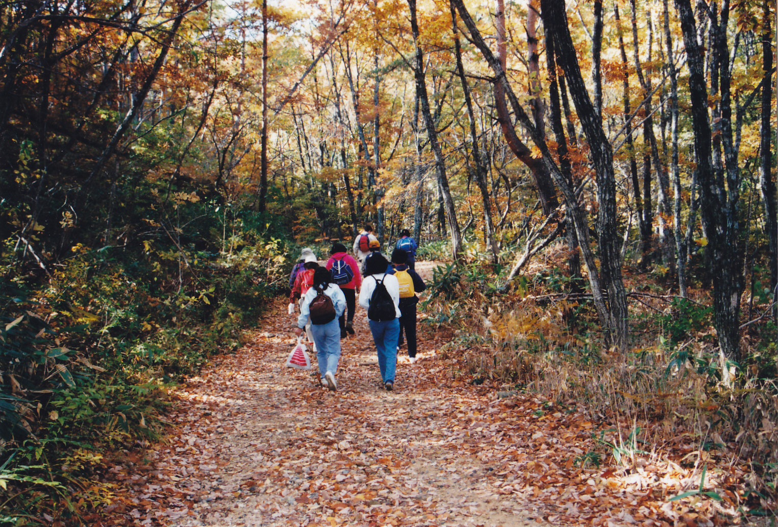
Mt. Hijiri (1,113m) |
|

|
|
|
Kita-Hiroshima Town Yamagata-gun | |
|
聖山 | |
| Map | Hikers walk up Mt. Hijiri which is one of the best places to see autumn leaves. |
|
Mt. Hijiri is located in the Geihoku area, Kita-Hiroshima Town, which is the northeasternmost part of
Hiroshima Prefecture, bordering Shimane Prefecture. Upper reaches of the Shibaki River, a branch of the Ota River which flows into Hiroshima Bay, were dammed in 1957 to make a lake and produce electricity. The lake is named Hijiri-ko ( Lake Hijiri). From the lake, take a 1.5-hour ascent to the top of Mt. Hijiri. If the weather permits, a breathtaking view of the lake can be seen from the rocks below the summit with scenic mountains including Mt. Garyu and Mt. Shinnyu as a background. This area is one of the habitats of Tsukinowaguma bears so it is recommended to put a bell on your backpack in order to let them know of your presence. After going down the same trail to the lake, you can make a 20-minute round trip to Mitsudaki Falls (quintupled-stepped falls) which is one of five wonders of Sandankyo Valley. Getting there: Go by car. Travel on the Chugoku Expressway heading west, and get off at the Togouchi exit. Then take Route 191 north for about 30 kilometers to the entrance of Lake Hijiri in the Geihoku area, and make a left turn. Cross the dam and the parking area is on the left. Follow the signboard that reads " 聖湖 ”which means Lake Hijiri. It will take about two hours from Central Hiroshima. Suggested schedule: Hiroshima(8:00)==(Chugoku Expressway)==Togouchi Exit===Lake Hijiri(10:00)--- ---Mt. Hijiri(11:30-12:30)---Lake Hijiri(13:30)---Mitsudaki Falls--- ---Lake Hijiri(14:30)==(Rte.191)==Togouchi(15:00)===Hiroshima(16:30) Note: To be safe, especially in winter, keep in mind not to go into the mountains alone, and be sure to go with a well-experienced hiker. |
|