| Top Page | Mountains, Valleys & Waterfalls |
|
Mt. Furutaka (392m) |
|
|
|
|
Etajima Town Etajima City | |
|
古鷹山 | |
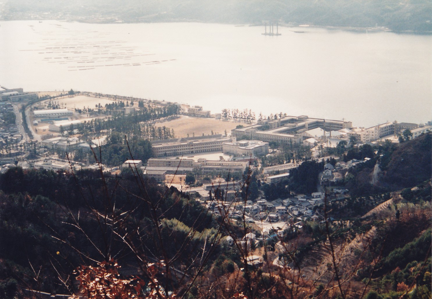
| Map | A view of the old Naval Academy (now the Maritime Self-Defense Force’s First Service and Officer Candidate School) from Mt. Furutaka |
|
Etajima Island is connected to the mainland via two bridges. One is Ondo-Ohashi Bridge which links Kure to
Kurahashi Island, and the other is Hayase-Ohashi Bridge which connects Kurahashi and Etajima Islands.
It is some distance away from central Hiroshima. It is a two-hour drive. But ferry and speed boat services
from Hiroshima and Kure Ports provide visitors easy access to the island. An old Naval Academy, which was said to be one of the best naval academies in the world, was there before World War II. The students of the academy used to run up Mt. Furutaka for training. Now its beautiful buildings, which were made of granite and brick, are the Maritime Self-Defense Force’s First Service and Officer Candidate School. There is an educational museum in the school where many items concerning the old academy are on display. From Kirikushi Port head south walking up for half an hour on the paved road and enter the mountain trail to take an hour ascent to the mountain. Needless to say, a splendid panoramic view can be seen from the summit of the mountain. Take an hour descent to MSDF School. You can visit the school or drop by nearby Etajima Hachiman Shrine from where you can see a good view of the whole school with Mt. Furutaka for a background. To return take a bus to Koyo Port in the southeast of the island. From Koyo Port ride a ferry boat for Kure Port for 20 minutes. And take a train to get back to Hiroshima. Getting there: Take a street car No. 5 for Hiroshima Port (via Hijiyama-shita) for 35 minutes. and take a 30-munute ferry ride to Kirikushi Port in the north of Etajima Island. Suggested schedule: Hiroshima Port(9:20)==(Ferry boat)==Kirikushi Port(9:50)--- ---Mt. Furutaka(11:45-12:45)---MSDF School(13:45)--- ---Etajima Hachiman Shrine==(Bus)==Koyo Port (14:47)== ==(Ferry boat)==Kure Port (15:07)---JR Kure Station (15:27)== ==(Kure Line)==Hiroshima Station (16:17) *Train and ferry timetables may be subject to change. Note: To be safe, especially in winter, keep in mind not to go into the mountains alone, and be sure to go with a well-experienced hiker. |
|