| Top Page | Mountains, Valleys & Waterfalls |
|
Mt. Takamura (Chikurinji) (535m) |
|
|

|
|
Kochi Town Higashi-Hiroshima City | |
|
篁山(竹林寺) 河内町 | |
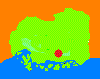
| Map | In spring many beautiful flowers bloom in and around the pond, Yachiyoike, such as irises, lotus flowers and hydrangeas. |
|
Chikurinji Temple, situated on the 535-meter Takamura mountain, is located in Kochi Town,
Higashi-Hiroshima City. The starting point is JR Nyuno Station of the Sanyo Line. First cross Route 432, and walk up the slope which leads to a residential area called Grunen Nyuno, for about 10 minutes to the trail head of the mountain where there is a parking place. There is a good well there from which you can pump mineral water. Walk up a 1.6-kilometer mountain trail to Chikurinji Temple for about one hour. The temple is surrounded by old cedar trees and a bamboo grove along with a spring called Yachiyo-ike. This area is designated as a prefectural nature park. Old picture scrolls of the temple say as follows: It was founded by a great monk, Gyoki, in 730. When he was going on a pilgrimage along the coast of the Inland Sea in Takehara, he saw a shining object like a sacred light on a mountain. It led him to the mountain, and he found a huge brilliant cherry tree in full bloom. He cut the tree and sculpted it to make a Senju Kannon,a Buddha statue with a thousand hands, to save people from various hardships. The Kannon statue became the temple's principal image. Now these old picture scrolls are open to the public at Hiroshima University’s Digital Local Library. To descend take a paved road to JR Kochi Station for about 1.5 hours. Getting there: Take a train on the Sanyo Line, and get off at Nyuno Station. Suggested schedule: Hiroshima(8:45)==(Sanyo Line)==Nyuno Station (9:38)--- ---Entry point of Chikurinji Temple (10:00)--- ---Chikurinji Temple (11:30-13:00)---Kochi Station (15:04)== ==(Sanyo Line)===Hiroshima Station (16:00) *Train timetables may be subject to change. Note: To be safe, especially in winter, keep in mind not to go into the mountains alone, and be sure to go with a well-experienced hiker. |
|